

In British Columbia Kees Lokman at UBC has been creating an open-source database called Living with Water as a sea rise of one half a meter is expected along the coast by 2050 and by one meter in 2100. Most of people in the province live close to water, with sixty percent living in Metro Vancouver.
In this article by CBC’s Brenna Lo, Mr. Lokman states that every municipality must have a person on staff dealing specifically with coastal issues, and stormwater management. The bad news is that the most fertile land in Canada is located along the Fraser River and one-third will be impacted by flooding, threatening food security. Areas that receive some flooding in high tides now will be permanently underwater by 2050.
Eric Niler in Wired.com has written about increased flooding along North American ocean coasts, identifying dredging and sea rise resulting in troublesome high tides. In Vancouver the “king tides” (a completely unscientific term used to describe tides during the full and new moon) have municipal attention, with the City of Vancouver asking people to photograph high tides in the city, and send images to the City for a photographic record and future resource.
Science Advances has just published this article that looks at the acceleration in sea rise level, and notes that the gap between high water levels and flood thresholds is shrinking. With an “assumed universal sea rise level of 150mm (five inches) “gently sloped topography” and “porous rocks” mean some areas will be more compromised than others.
What is groundbreaking about this study is it is the first one to connect “nuisance flooding” to sea level rise and the man-made changes along the coasts which make it easier for water to flow inland.
Sea levels have increased 208 to 220 mm (8 to 9 inches) in the last 140 years, especially impacting the east and gulf coasts of the United States.
Dredging and channel deepening, which have been done on the Fraser River near Richmond B.C. also exacerbates flooding. Concerns about airport field flooding have been identified by pilots and scientists at New York City’s JFK airport, San Francisco, Oakland, New Orleans, Miami, Fort Lauderdale, Newark, and Washington, DC.
The worst damage occurs when coastal flooding, erosion coincide with storm waves and high peak tides.
There are already some forms of mitigation and studies are underway to look at restoring parts of San Francisco’s East Bay and unused river channels in New York Harbour to mitigate the rise of incoming tides on the main channel.
While conventional seawall barricades and dikes might be used in False Creek, “floating wetlands and kelp beds, clam gardens and living dikes” can be installed on watery “sediment deposits ” to naturally control rising waters.
The Fraser Basin Council has a draft Lower Mainland Flood Management Strategy that estimates future flooding will result in 20 to 30 billion dollars of economic loss. Metro Vancouver has had significant floods, the largest most recently in 1948. The report notes that regional development has been growing on flood plain hazard areas , putting at risk these areas and the critical infrastructure that supports them.
Some municipalities like Delta have recognized rising sea levels as a 21st century challenge. Delta Optimist’s Sandor Gyarmati writes that Delta has already been applying for Federal grants to bolster the dike system which serves much of that city’s low lying areas. Land use decisions have placed many buildings, infrastructure and people on flood hazard areas, with dikes that may fail during a major flood.
There is a need to recognize the scope of the problem and work across the region to create a coastal adaptation plan which includes First Nations experience and knowledge.
The video below talks about king tides and sea rise and was produced by the City of Vancouver.


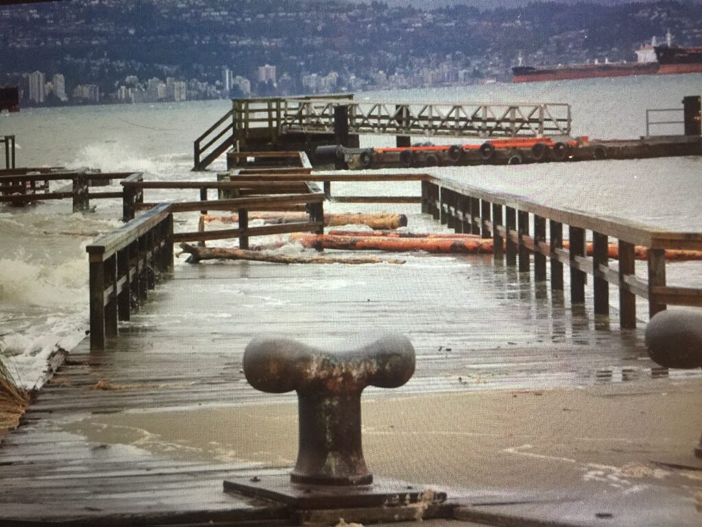
The Jericho Pier (pictured in the story) will be replaced with one 2.5 metres taller, although I don’t know the current status. It was approved by the Park Board in 2017.
https://dailyhive.com/vancouver/jericho-pier-approved-vancouver-park-board-november-2017?auto=true
And yet the South Marine neighbourhood which is likely prone to flooding is getting intense new residential development…