
Another item from “Designing for People of All Ages and Abilities: Active Transportation & Health in Vancouver” by Active Transportation Manager Dale Bracewell.
.
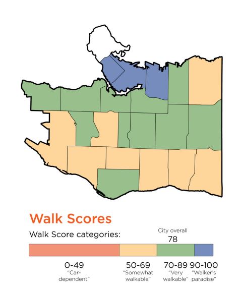
Today:
.
The goal:
By 2025, every Vancouver neighbourhood has a “Walk Score” of at least 70, meaning most errands can be done on foot.


My first impression is that it’s mostly right. The southern half of the city is one big slope and doesn’t have much retail mixed in with the housing. The older northern half has more shopping streets and more high volume destinations.
If the map were more granular you wouldn’t see so many obvious “mistakes” like Dunbar Heights and Kerrisdale Village being yellow and my old Kensington neighbourhood being green despite the fact that it contains virtually no shops whatsoever. I remember driving 5km to the grocery store when we first moved there.
This leads to me ask: wouldn’t it be just as effective in reducing car trips to encourage small commercial hubs in the midst of the low walk score areas than promote the runaway development that is now happening along some arterials? Think the scale that exists at 33rd and Mackenzie or 57th and East Boulevard.