
What, in any city, is the most important public space?
Why, the street, of course. Streets comprise the largest percentage of a city jointly owned and occupied by its citizens. No streets, no city.
So the layout is critical: the surveyor, or whoever first lays out the connected system of arterials, determines how every generation thereafter will function in the city. No other urban designer will be as influential in creating a mental map and sense of place.
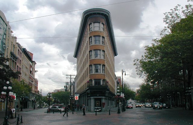
North American cities, particularly those beyond the initial east-coast settlements seemingly laid out in random patterns, are usually gridded. The first street will be parallel to the waterfront, with inland streets either parallel to the first or at perpendicular angles – until the coastline shifts. In our case, when Alexander Street meets Water Street, the road shifts at an acute angle, creating a triangular lot and an opportunity for a flatiron-style edifice.
.
.
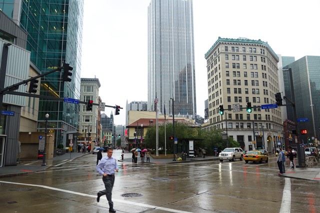
Or Hastings at Burrard, where the slight shift in angle created the opportunity for the Marine Building.
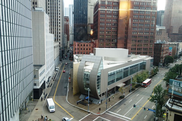
And then there’s Pittsburgh. Because the Allegheny and Monongahela Rivers created a triangular townsite, the first settlers established two parallel dockside arterials on either side of the point to serve the wharves and bridges. And then (mostly) joined up the perpendicular streets by angling them at Liberty, to create a grid that looks like this:
.

.
It may be a constant source of anguish for traffic engineers, but the result is a townscape with shifting perspectives, intriguing angles and opportunities for buildings, parks and plazas which through no more than their triangular shapes or chamfered cuts offer variations that make Pittsburgh more architecturally dynamic – without being overly confusing.
.
 .
.


When that intersection above (Alexander at Powell) meets at an angle, and is called “Maple Tree Square”, I say it’s an invitation to turn it into a pedestrian square! http://www.tinyurl.com/pedestrianize-water-street/
Reblogged this on CitraGran Cibubur.