
An occasional update on items from the Transit City.
______________________________________________________________
.
THINKING OUT LOUD
Jarrett Walker contemplates the impact on transit of cuts in U.S. federal funding to American cities:
The transition to a more Canada-like Federal role would be hell. Everyone involved is understandably horrified by the prospect, including me much of the time. But if the Federal budget-slashers win, US cities and states will be on that course whether they like it or not. Are we sure the eventual outcome would be a disaster?
More here in Human Transit.
______________________________________________________________
.
PLUG-IN MOBILITY
Recently, Latitude released the results of its Tech for Transit: Designing a Future System open innovation study (published in collaboration with Next American City). The study, which asked regular drivers in Boston and San Francisco to go car-free for one full week, uncovered opportunities for mobile information to reduce our dependence on driving by improving the experience of taking more sustainable transit.
The study results are available here:
- Part 1: Deprivation Study Finds Access to Real-Time Mobile Information Could Raise the Status of Public Transit
- Part 2: Going Car-Free for a Week Uncovers Shift in Psychology: Is Ownership Really Necessary?
- Part 3: Tech for Transit Study Highlights Big Opportunities for Mobile
- Download the full Tech for Transit report summary (PDF) here
The Concept
We found that many of our study participants wanted a similar tool to help them make decisions about transit: a “one-stop information shop”—a mobile or Web application that would enable users to choose among multiple options (bus vs. car-sharing vs. train) by comparing schedules, cost, availability, and convenience.
______________________________________________________________
.
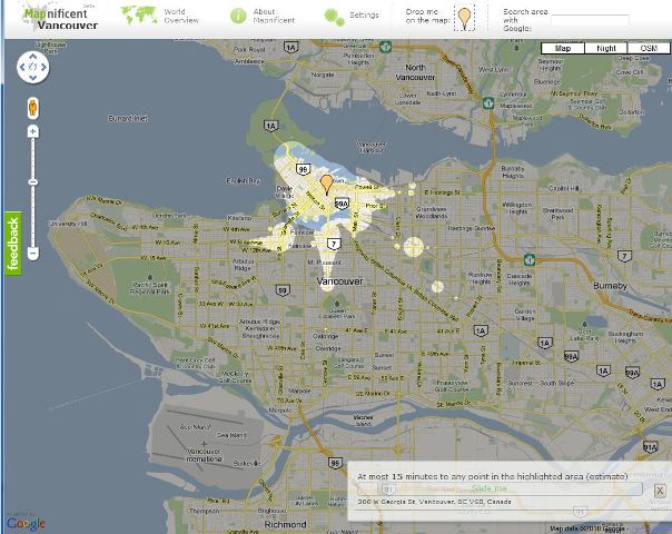
HAPPY MAPPING
I ran this before, but worth another mention:
You have a couple hours to kill in a new city, but don’t have the slightest clue how long it will take you on public transportation to get to all the good tourist destinations. Mapnificent, a Google Maps-based program that shows how far you can go using public transportation in a certain amount of time, can help.

Still won’t work on the Explorer web browser, though.
______________________________________________________________


Time to get a real browser 🙂
What a great idea! I hope he keeps developing this.